

National Bridge Inventory (NBI)
U.S. Federal Highway Administration
- License
- Public domain
- Commercial
- Yes
- Format
- CSV
- Coverage
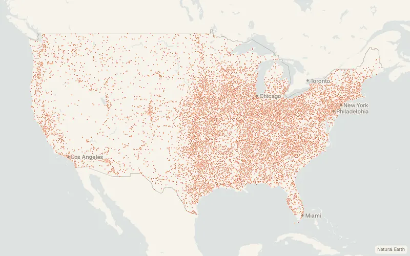
- United States, ~620,000 bridges
- Projection
- EPSG:4326 · WGS 84
- Last updated
- 11 Aug 2025 · Update frequency Annual
Tags
FHWA took Coding Guide ASCII files through 2025, after specifications moved to SNBI in 2022.
CartaTerra can export this layer as GeoPackage, Shapefile, GeoJSON, KML, CSV, or GPX.
Source and attribution
- Publisher
- U.S. Federal Highway Administration
- License
- Public domain
- Commercial use
- Yes
- Attribution required
- No
- Modification allowed
- See publisher
- Redistribution allowed
- See publisher
- Share-alike
- No
- Region
- United StatesUS
- Type
- Vector
- Extent
- -179.217.6-64.571.4West, south, east, north. Approximate region extent.
Related datasets
- InfrastructureU.S. Wind Turbine Database (USWTDB)VectorUnited StatesPowerLand-based and offshore wind turbines sited in the United States.
- InfrastructureU.S. Large-Scale Solar Photovoltaic Database (USPVDB)VectorUnited StatesOutlines of US photovoltaic plants with capacity of at least 1 MW.
- InfrastructureEmissions & Generation Resource Integrated Database (eGRID)VectorUnited StatesPowerUS power plants with net generation, fuel mix, and air emissions.
- InfrastructureFCC Antenna Structure Registration (ASR) DatabaseVectorUnited StatesRegistered antenna structures, with location, height, and lighting details.
- InfrastructureProvider of Services File - Quality Improvement and Evaluation System (hospital & non-hospital facilities)VectorUnited StatesCertification records for hospitals and other facilities enrolled in Medicare.
- InfrastructureHospital General InformationVectorUnited StatesMedicare-registered hospitals, with address, type, and an overall rating.