

U.S. Large-Scale Solar Photovoltaic Database (USPVDB)
U.S. Geological Survey / Lawrence Berkeley National Laboratory
- License
- Public domain
- Commercial
- Yes
- Format
- Shapefile, CSV, GeoJSON
- Coverage
- United States, PV facilities ≥1 MW
- Last updated
- Added to findgis 29 Oct 2026 · Update frequency Annual
Tags
USGS and Berkeley Lab array boundaries, with panel type, site type, and the year operation started.
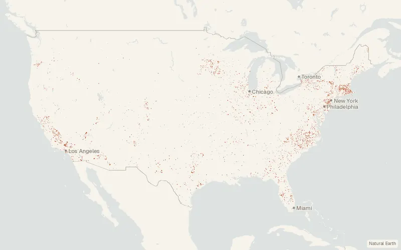
Some publishers block opening this file in another site. CartaTerra will offer a download and upload instead.
Source and attribution
- Publisher
- U.S. Geological Survey / Lawrence Berkeley National Laboratory
- License
- Public domain
- Commercial use
- Yes
- Attribution required
- No
- Modification allowed
- See publisher
- Redistribution allowed
- See publisher
- Share-alike
- No
- Region
- United StatesUS
- Type
- Vector
- Download
- Shapefile (zip)
- Extent
- -179.217.6-64.571.4West, south, east, north. Approximate region extent.
Related datasets
- TransportationNational Bridge Inventory (NBI)VectorUnited StatesFederal records cover about 620,000 bridges across the United States.
- TransportationHighway Performance Monitoring System (HPMS) Public Release ShapefilesVectorUnited StatesRoadsHighway Performance Monitoring System Public Release Shapefiles.
- TransportationClass Airspace (FAA Aeronautical Data)VectorUnited StatesControlled airspace classes over the US, Puerto Rico, and the US Virgin Islands.
- TransportationFatality Analysis Reporting System (FARS)VectorUnited StatesA nationwide census records fatal motor-vehicle crashes in the United States since 1975.
- TransportationFAA Aeronautical Data (28 Day NASR Subscription and ADDS)VectorUnited StatesLayout and operating status of the National Airspace System, every 28 days.
- TransportationFreight Analysis Framework Version 5 (FAF5.7.1)VectorUnited StatesFreight flows among states and major metro areas, by mode, version 5.