

U.S. Wind Turbine Database (USWTDB)
U.S. Geological Survey / Lawrence Berkeley National Laboratory / American Clean Power Association
- License
- Public domain
- Commercial
- Yes
- Format
- Shapefile, CSV, GeoJSON
- Coverage
- United States (land-based and offshore)
- Last updated
- Added to findgis 29 Oct 2026 · Update frequency Quarterly
USGS, Berkeley Lab, and ACP locations with project details and turbine specifications, updated continuously.
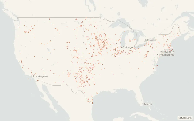
Some publishers block opening this file in another site. CartaTerra will offer a download and upload instead.
Source and attribution
- Publisher
- U.S. Geological Survey / Lawrence Berkeley National Laboratory / American Clean Power Association
- License
- Public domain
- Commercial use
- Yes
- Attribution required
- No
- Modification allowed
- See publisher
- Redistribution allowed
- See publisher
- Share-alike
- No
- Region
- United StatesUS
- Type
- Vector
- Download
- Shapefile (zip)
- Extent
- -179.217.6-64.571.4West, south, east, north. Approximate region extent.
Related datasets
- TransportationNational Bridge Inventory (NBI)VectorUnited StatesFederal records cover about 620,000 bridges across the United States.
- TransportationHighway Performance Monitoring System (HPMS) Public Release ShapefilesVectorUnited StatesRoadsHighway Performance Monitoring System Public Release Shapefiles.
- TransportationClass Airspace (FAA Aeronautical Data)VectorUnited StatesControlled airspace classes over the US, Puerto Rico, and the US Virgin Islands.
- TransportationFatality Analysis Reporting System (FARS)VectorUnited StatesA nationwide census records fatal motor-vehicle crashes in the United States since 1975.
- TransportationFAA Aeronautical Data (28 Day NASR Subscription and ADDS)VectorUnited StatesLayout and operating status of the National Airspace System, every 28 days.
- TransportationFreight Analysis Framework Version 5 (FAF5.7.1)VectorUnited StatesFreight flows among states and major metro areas, by mode, version 5.