

National Parks (England)
Natural England
- License
- Attribution
- Commercial
- Yes
- Format
- GeoJSON, GeoPackage, Shapefile
- Coverage
- England
- Projection
- EPSG:27700
- Last updated
- Added to findgis 29 Oct 2026 · Update frequency Irregular
Yorkshire Dales and Lake District limits changed on 1 August 2016, and the South Downs changed on 2 June 2010.
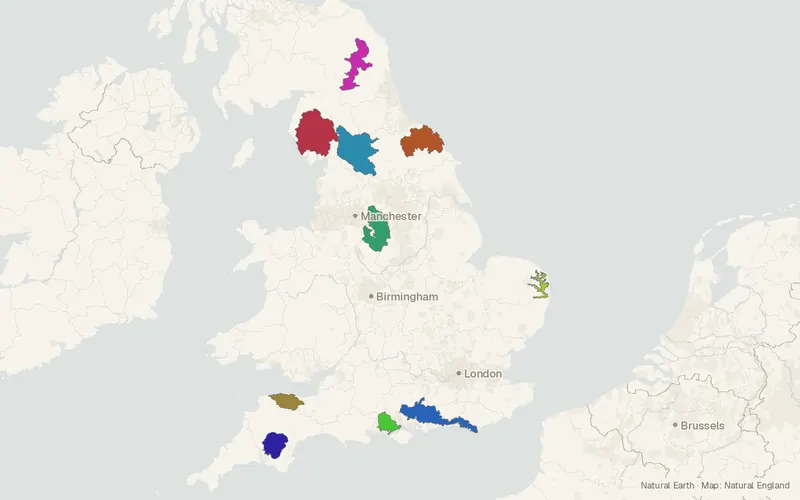
CartaTerra can export this layer as GeoPackage, Shapefile, GeoJSON, KML, CSV, or GPX.
Source and attribution
- Publisher
- Natural England
- License
- Attribution
- Commercial use
- Yes
- Attribution required
- Yes
- Modification allowed
- Yes
- Redistribution allowed
- Yes
- Share-alike
- No
- Region
- EuropeGB
- Type
- Vector
- Download
- National_Parks_England.gdb.zipNational_Parks_England.geojson.zipNational_Parks_England.gpkg.zipNational_Parks_England.shp.zip
- Service
- WFShttps://environment.data.gov.uk/spatialdata/national-parks-england/wfsWMShttps://environment.data.gov.uk/spatialdata/national-parks-england/wmsArcGIShttps://environment.data.gov.uk/arcgis/rest/services/NE/NationalParksEngland/FeatureServer
- Extent
- -4.430650.35321.997355.5914West, south, east, north. Data extent.
Related datasets
- EcologyAncient Woodland (England)VectorEuropeForestWoodland mapped in England has remained wooded continuously since at least 1600.
- Public landCRoW Act 2000 - Access LayerVectorEuropeOpen country and registered common land are shown as access land in England.
- EcologyPriority Habitats Inventory (England)VectorEuropeSpeciesTwenty-seven priority habitats are mapped across England for biodiversity.
- Protected areasSites of Special Scientific Interest (England)VectorEuropeNotified wildlife and natural-feature sites spread across England.
- Protected areasAreas of Outstanding Natural Beauty / National Landscapes (England)VectorEuropeParksLandscapes in England designated for natural beauty outside national parks.
- TrailsNational Trails (England)VectorEuropeLong walking, cycling, and horse-riding routes are designated across England.