

Areas of Outstanding Natural Beauty / National Landscapes (England)
Natural England
- License
- Attribution
- Commercial
- Yes
- Format
- Shapefile, GeoJSON, CSV
- Coverage
- England
- Projection
- EPSG:27700
- Last updated
- 18 Jun 2024 · Update frequency Irregular
Natural England designates them, and the areas are also called National Landscapes.
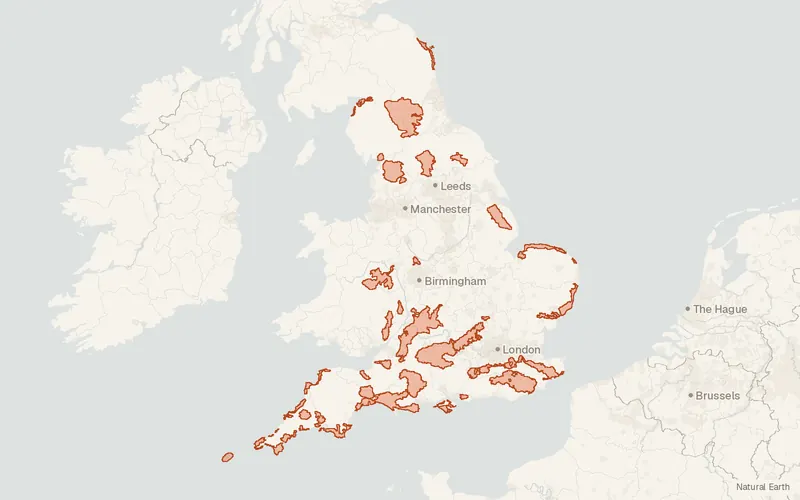
CartaTerra can export this layer as GeoPackage, Shapefile, GeoJSON, KML, CSV, or GPX.
Source and attribution
- Publisher
- Natural England
- License
- Attribution
- Commercial use
- Yes
- Attribution required
- Yes
- Modification allowed
- Yes
- Redistribution allowed
- Yes
- Share-alike
- No
- Region
- EuropeGB
- Type
- Vector
- Extent
- -6.4549.861.7755.81West, south, east, north. Approximate region extent.
Related datasets
- EcologyPriority Habitats Inventory (England)VectorEuropeSpeciesTwenty-seven priority habitats are mapped across England for biodiversity.
- Public landCRoW Act 2000 - Access LayerVectorEuropeOpen country and registered common land are shown as access land in England.
- EcologyAncient Woodland (England)VectorEuropeForestWoodland mapped in England has remained wooded continuously since at least 1600.
- ElevationLIDAR Composite DTM/DSM (England)RasterEuropeDEMLidarBare-earth elevations at 1 m covering about 99 percent of England.
- BoundariesLower layer Super Output Areas (December 2021) Boundaries EW BFC (V10)VectorEuropeLower layer Super Output Areas Boundaries EW BFC.
- Protected areasNational Parks (England)VectorEuropeParksOfficial lines trace the outer boundary of every national park in England.