

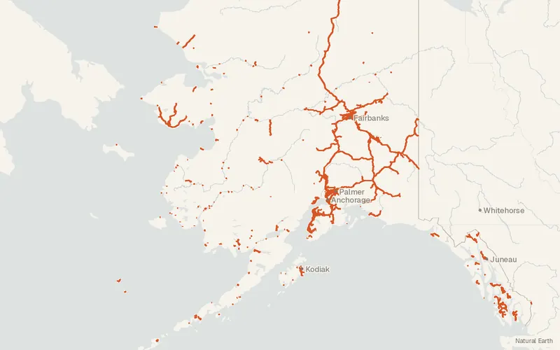
Roads AKDOT (Alaska)
Alaska Department of Transportation & Public Facilities
- License
- See publisher
- Commercial
- Yes
- Format
- Several
- Coverage
- Alaska, United States
- Projection
- EPSG:3338
- Last updated
- 3 Sep 2026 · Update frequency Irregular
The layer is meant to show public roads and does not assign ownership. Realignments are added when a road opens, and other routes are reviewed every five years.
CartaTerra can export this layer as GeoPackage, Shapefile, GeoJSON, KML, CSV, or GPX.
Source and attribution
- Publisher
- Alaska Department of Transportation & Public Facilities
- License
- See publisher
- Commercial use
- Yes
- Attribution required
- Yes
- Modification allowed
- See publisher
- Redistribution allowed
- See publisher
- Share-alike
- See publisher
- Region
- United StatesUS · AK
- Type
- Vector
- Service
- ArcGIShttps://services.arcgis.com/r4A0V7UzH9fcLVvv/arcgis/rest/services/Roads_AKDOT/FeatureServer/0
- Extent
- -18051.562118071.373West, south, east, north. Data extent.
Related datasets
- BoundariesDOT&PF Region Boundary AKDOT (Alaska)VectorUnited StatesAlaska's transportation department divides the state into three administrative regions.
- InfrastructureU.S. Wind Turbine Database (USWTDB)VectorUnited StatesPowerLand-based and offshore wind turbines sited in the United States.
- InfrastructureU.S. Large-Scale Solar Photovoltaic Database (USPVDB)VectorUnited StatesOutlines of US photovoltaic plants with capacity of at least 1 MW.
- InfrastructureEmissions & Generation Resource Integrated Database (eGRID)VectorUnited StatesPowerUS power plants with net generation, fuel mix, and air emissions.
- InfrastructureFCC Antenna Structure Registration (ASR) DatabaseVectorUnited StatesRegistered antenna structures, with location, height, and lighting details.
- InfrastructureProvider of Services File - Quality Improvement and Evaluation System (hospital & non-hospital facilities)VectorUnited StatesCertification records for hospitals and other facilities enrolled in Medicare.