

Contours des 11 Parcs nationaux de France
Parcs nationaux de France
- License
- Attribution
- Commercial
- Yes
- Format
- GeoJSON
- Coverage
- France
- Last updated
- 11 Feb 2026 · Update frequency Static
Tags
Integral reserves cover Ecrins, Port-Cros, Guadeloupe, and Forêts, and adjacent marine areas are included.
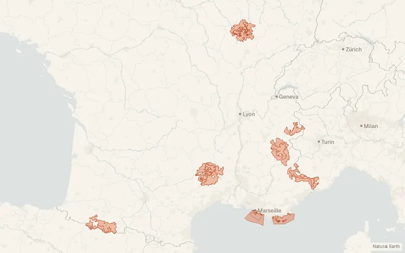
Some publishers block opening this file in another site. CartaTerra will offer a download and upload instead.
Source and attribution
- Publisher
- Parcs nationaux de France
- License
- Attribution
- Commercial use
- Yes
- Attribution required
- Yes
- Modification allowed
- Yes
- Redistribution allowed
- Yes
- Share-alike
- No
- Region
- EuropeFR
- Type
- Vector
- Time
- 1963-07-06–2019-11-06
- Extent
- -5.241.39.651.1West, south, east, north. Approximate region extent.
Related datasets
- Protected areasEspaces naturels protégés – FranceVectorEuropeParksProtected nature sites across France, from national parks to marine parks.
- BoundariesADMIN EXPRESS, ADMIN EXPRESS COG, ADMIN EXPRESS COG CARTO, ADMIN EXPRESS COG CARTO PE, ADMIN EXPRESS COG CARTO PLUS PE – FranceVectorEuropeAdministrative units of mainland France and the overseas departments.
- BoundariesParcellaire Express (PCI) – FranceVectorEuropeParcelsCadastral parcels assembled for the cadastre-covered territory of France.
- Points of interestBD TOPO® – FranceVectorEuropeBuildingsRoadsMetric three-dimensional features of France, including buildings, roads, and land cover.
- HydrologyBD Topage® - Métropole 2026 – FranceVectorEuropeHydrographyRiversLarge-scale rivers and surface waters of metropolitan France for 2026.
- HazardsBase de Données sur les Incendies de Forêts en France (BDIFF)VectorEuropeBase de Données sur les Incendies de Forêts.