

Paraguay – Subnational Administrative Boundaries (COD-AB)
UN OCHA (source: Dirección General de Estadísticas, Encuestas y Censos (DGEEC), INE: Instituto Nacionel de Estadistica Paraguay)
- License
- Attribution
- Commercial
- Yes
- Format
- GeoJSON, Shapefile
- Coverage
- Paraguay
- Last updated
- 24 Sep 2026 · Update frequency Irregular
Tags
Paraguay version 01 also lists 7994 barrio or localidad units and 105952 manzanas, the latter partial, with boundaries from 1 January 2022.
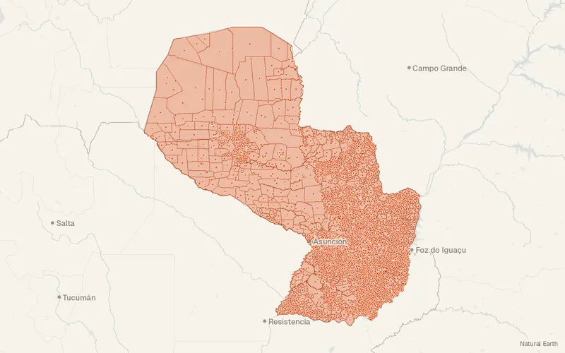
Some publishers block opening this file in another site. CartaTerra will offer a download and upload instead.
Source and attribution
- Publisher
- UN OCHA (source: Dirección General de Estadísticas, Encuestas y Censos (DGEEC), INE: Instituto Nacionel de Estadistica Paraguay)
- License
- Attribution
- Commercial use
- Yes
- Attribution required
- Yes
- Modification allowed
- See publisher
- Redistribution allowed
- See publisher
- Share-alike
- No
- Region
- South AmericaPY
- Type
- Vector
- Time
- 2026-07-29–2026-07-29
- Extent
- -62.69-27.55-54.29-19.34West, south, east, north. Data extent.
Related datasets
- BoundariesSubnational Administrative Boundaries, geoBoundaries (Paraguay)VectorSouth AmericaParaguay's geoBoundaries coverage runs from the country outline through level 2.
- EcologyAboveground Biomass 100 m, 2025 (Paraguay)RasterSouth AmericaEach 100 m cell over Paraguay holds a 2025 aboveground biomass estimate.