

Palestine, State of – Subnational Administrative Boundaries (COD-AB)
UN OCHA (source: Palestinian Authority Ministry of Planning)
- License
- Attribution
- Commercial
- Yes
- Format
- GeoJSON, Shapefile
- Coverage
- Palestine, State of
- Last updated
- 26 Jan 2026 · Update frequency Annual
Tags
The Palestinian Authority planning ministry supplied version 01, with boundaries created on 28 September 1995.
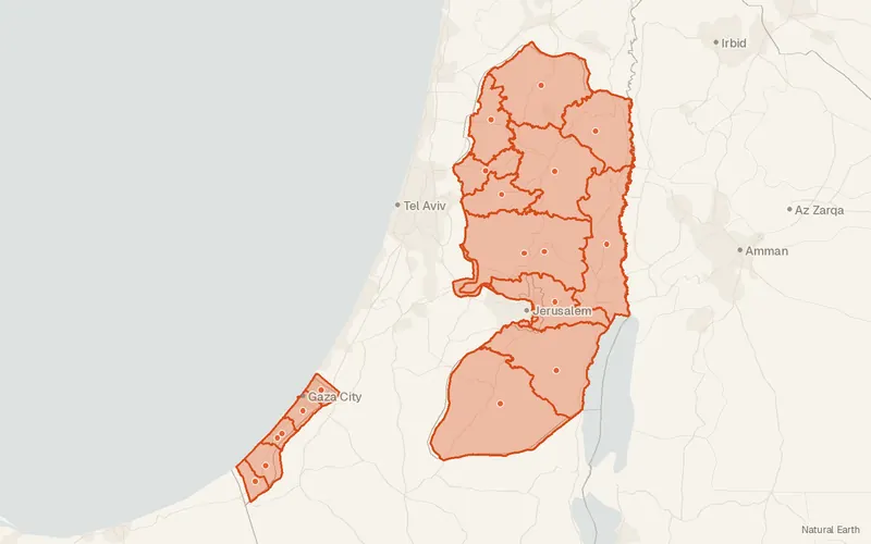
Some publishers block opening this file in another site. CartaTerra will offer a download and upload instead.
Source and attribution
- Publisher
- UN OCHA (source: Palestinian Authority Ministry of Planning)
- License
- Attribution
- Commercial use
- Yes
- Attribution required
- Yes
- Modification allowed
- See publisher
- Redistribution allowed
- See publisher
- Share-alike
- No
- Region
- Middle East & Central AsiaPS
- Type
- Vector
- Time
- 2023-10-19–2024-12-24
- Extent
- 34.9331.3535.5532.53West, south, east, north. Approximate region extent.
Related datasets
- Public landGaza Strip Buffer AreaVectorMiddle East & Central AsiaClosed and access-restricted areas are outlined inside the Gaza Strip.
- Public landWest Bank Separation BarrierVectorMiddle East & Central AsiaThe separation barrier across the West Bank is mapped as of January 2018.
- HydrologyState of Palestine - HydrographyVectorMiddle East & Central AsiaHydrographyRiversLakesCoastlineWater bodies, coastline, and rivers are charted for the State of Palestine.
- TransportationPalestine Crossings with IsraelVectorMiddle East & Central AsiaCrossing points link the West Bank and the Gaza Strip with Israel.
- InfrastructureState of Palestine - Health FacilitiesVectorMiddle East & Central AsiaHealth facilities in the Gaza Strip and the West Bank are located as of November 2023.