

Iraq – Subnational Administrative Boundaries (COD-AB)
UN OCHA (source: Iraq Central Statistics Office)
- License
- Attribution
- Commercial
- Yes
- Format
- GeoJSON, Shapefile
- Coverage
- Iraq
- Last updated
- 26 Jan 2026 · Update frequency Annual
Tags
Iraq's statistics office supplied version 01, with boundaries created on 5 June 2019.
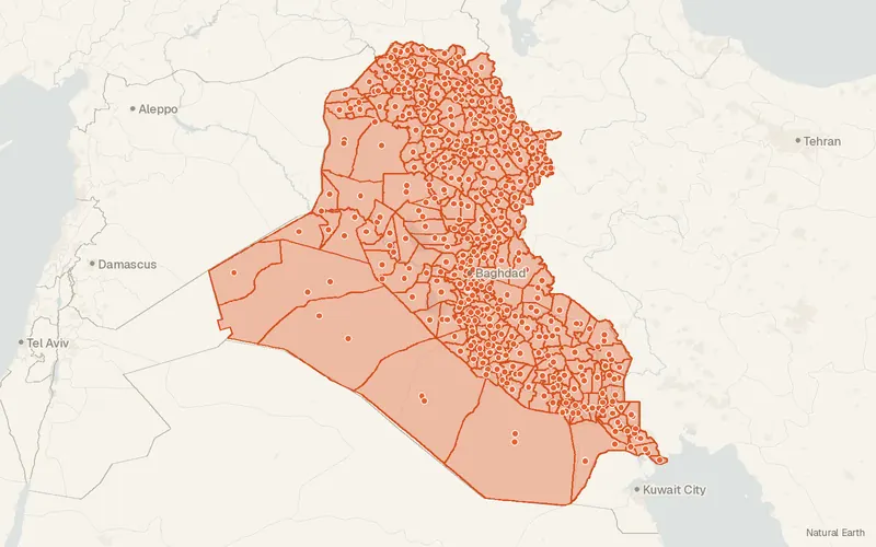
Some publishers block opening this file in another site. CartaTerra will offer a download and upload instead.
Source and attribution
- Publisher
- UN OCHA (source: Iraq Central Statistics Office)
- License
- Attribution
- Commercial use
- Yes
- Attribution required
- Yes
- Modification allowed
- See publisher
- Redistribution allowed
- See publisher
- Share-alike
- No
- Region
- Middle East & Central AsiaIQ
- Type
- Vector
- Time
- 2019-06-03–2024-12-19
- Extent
- 38.7929.148.5737.39West, south, east, north. Data extent.
Related datasets
- HydrologyIraq - Water Courses (Rivers and Streams)VectorMiddle East & Central AsiaHydrographyRiversStream and river courses in Iraq are traced on a 2004 baseline at 1:50,000.
- HydrologyIraq - Water Bodies (Lakes and Ponds)VectorMiddle East & Central AsiaHydrographyLakesLakes and ponds across Iraq come from 2004 baseline mapping at 1:50,000.
- BoundariesSyria – Subnational Administrative Boundaries (COD-AB)VectorMiddle East & Central AsiaFourteen governorates, 62 districts, and 272 sub-districts divide Syria.