

Chile – Subnational Administrative Boundaries (COD-AB)
UN OCHA (source: La Biblioteca del Congreso Nacional de Chile (BCN))
- License
- Attribution
- Commercial
- Yes
- Format
- GeoJSON, Shapefile
- Coverage
- Chile
- Last updated
- 26 Jan 2026 · Update frequency Annual
Tags
OCHA version 01 holds administrative levels 0 through 3 for Chile.
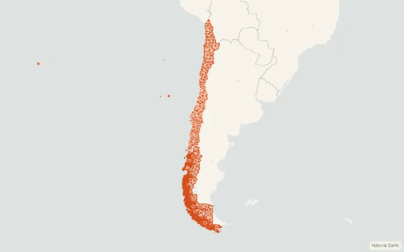
Some publishers block opening this file in another site. CartaTerra will offer a download and upload instead.
Source and attribution
- Publisher
- UN OCHA (source: La Biblioteca del Congreso Nacional de Chile (BCN))
- License
- Attribution
- Commercial use
- Yes
- Attribution required
- Yes
- Modification allowed
- See publisher
- Redistribution allowed
- See publisher
- Share-alike
- No
- Region
- South AmericaCL
- Type
- Vector
- Time
- 2021-10-08–2025-02-17
- Extent
- -75.64-55.61-66.96-17.58West, south, east, north. Data extent.
Related datasets
- Public landChile – Propiedad Fiscal Administrada (Bienes Nacionales)VectorSouth AmericaState property areas in Chile under a lease, concession, easement, or permit.
- Public landChile – Áreas de Desarrollo IndígenaVectorSouth AmericaIndigenous development areas in Chile, with ethnicity, communes, and extent.
- Points of interestChile – Monumentos y Patrimonio UniversalVectorSouth AmericaNational monuments and sites of universal heritage value across Chile.
- Points of interestChile – Patrimonio HistóricoVectorSouth AmericaMuseum and library points across Chile, each with a location and web link.
- Points of interestChile – Atractivos TurísticosVectorSouth AmericaTourist attraction sites across Chile, noting public or private management and demand.
- Points of interestChile – Patrimonio ArqueológicoVectorSouth AmericaRecorded archaeological heritage sites and areas throughout Chile.