

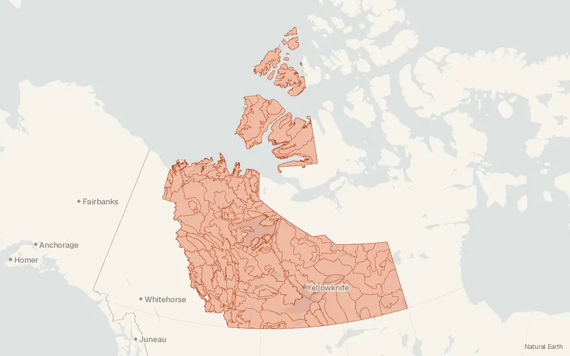
Coverage preview
EcoRegions (Northwest Territories)
Data: Government of the Northwest Territories, Environment and Natural Resources (Forest Management Division); NWT Centre for Geomatics · Basemap: Natural Earth
- License
- Attribution
- Commercial
- Yes
- Format
- Shapefile
- Coverage
- Northwest Territories, Canada
- Added to findgis
- 30 Oct 2026Static
Landscape ecoregions of the Northwest Territories, classified for assessment, biodiversity monitoring, forest planning, and wildlife habitat.
From the publisher
Northern landscapes, with their vast forests, numerous wetlands, bogs, lakes and rivers, play an important role in enhancing our environment by producing clean air and clean water. These landscapes can be grouped and described as smaller ecological regions (ecoregions), using several physical characteristics at a variety of scales. The Northwest Territories (NWT) has developed an ecologically based landscape classification for environmental assessment, cumulative effects management, biodiversity monitoring and reporting, forest resource analysis and planning, wildlife habitat evaluation and conservation, and protected areas identification. The NWT Ecosystem Classification Program began in 2004 – its purpose to revise the ecozones and ecoregions of the NWT, as they were defined under the national ecosystem classification system (A National Ecological Framework for Canada - 1996). The revision process recognises the need to obtain an updated and more relevant ecosystem classification that reflects best current information and analytic techniques, and that can be used to better manage natural resources in the NWT. Ecosystem classification revisions and mapping have been completed for the five regions of the NWT (Taiga Plains, Taiga Shield, Cordillera, Southern Arctic, Northern Arctic). Ecological classification and mapping for the NWT are presented within an ecoregion framework for continental North America that includes four levels, from very large level I ecoregions that represent ecosystems of global extent (biomes), to relatively small level IV ecoregions that may cover only a few hundred square kilometres. Level II Ecoregions are represented by major physiographic features, indicated by general climate and landforms. Level III Ecoregions are represented by regional climatic patterns, indicated by temperature, solar energy, and precipitation levels Level IV Ecoregions are represented by physiographic patterns interacting with regional climates (combination of Level II & Level III Ecoregions), typically expressed by vegetation and/or soils.
CartaTerra can export this layer as GeoPackage, Shapefile, GeoJSON, KML, CSV, or GPX.