

High Resolution Digital Elevation Model (HRDEM)
Natural Resources Canada
- License
- Attribution
- Commercial
- Yes
- Format
- GeoTIFF
- Coverage
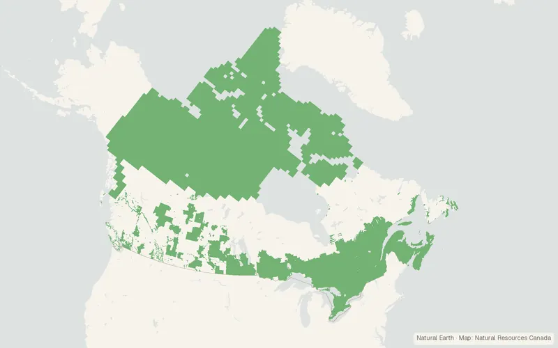
- Canada (partial), 1–2 m
- Projection
- EPSG:3978
- Last updated
- Added to findgis 27 Oct 2026 · Update frequency Irregular
Tags
High-resolution 1 to 2 m elevation models covering parts of Canada.
CartaTerra can export this layer as GeoPackage, Shapefile, GeoJSON, KML, CSV, or GPX.
Source and attribution
- Publisher
- Natural Resources Canada
- License
- Attribution
- Commercial use
- Yes
- Attribution required
- Yes
- Modification allowed
- Yes
- Redistribution allowed
- Yes
- Share-alike
- No
- Region
- CanadaCA
- Type
- Raster
- Time
- 2006-04-28 onward
- Download
- DTM derived data (download directory)DSM derived data (download directory)HRDEM Dataset Footprints by coordinate systemHRDEM Project Footprints
- Extent
- -14141.68-52.6283.11West, south, east, north. Data extent.
Related datasets
- HydrologyNational Hydro Network - NHN - GeoBase Series (Canada)VectorCanadaHydrographyRiversLakesLakes, rivers, canals, and islands in Canada's inland hydro network.
- BoundariesCanVec Topographic Data of CanadaVectorCanadaTopographic base layers for mapping at 1:50,000.
- Public landAboriginal Lands of Canada Legislative BoundariesVectorCanadaAboriginal land boundaries in Canada for reserves and claim-settlement lands.
- HazardsCanadian Forest Fire Danger Rating System (CFFDRS) Fire Behaviour Prediction (FBP) Fuel Types 2024, 30 MRasterCanadaWildfireForestCanadian Forest Fire Danger Rating System Fire Behaviour Prediction Fuel Types.
- HazardsCanada Landsat Burned Severity (CanLaBS v2): a Canada-wide Landsat-based 30m resolution product of burned severity since 1985.RasterCanadaCanada Landsat Burned Severity a Canada-wide Landsat-based resolution product of burned.
- Land coverCanada Landsat Disturbance (CanLaD) – Including Forest Insect PestRasterCanadaForestCanada Landsat Disturbance Including Forest Insect Pest.