

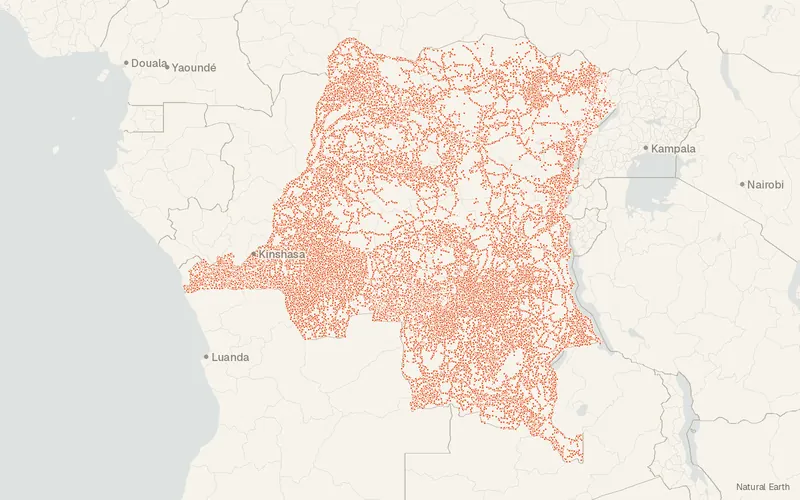
the Democratic Republic of the Congo – GRID3 Settlement Names v9.0
GRID3
- License
- Attribution
- Commercial
- Yes
- Format
- GeoPackage
- Coverage
- the Democratic Republic of the Congo
- Last updated
- 8 Sep 2026 · Update frequency Static
Tags
Version 9 refreshes Haut-Katanga, Haut-Lomami, Ituri, Kwango, Lomami, Maniema, and Tanganyika through February 2026.
Source and attribution
- Publisher
- GRID3
- License
- Attribution
- Commercial use
- Yes
- Attribution required
- Yes
- Modification allowed
- See publisher
- Redistribution allowed
- See publisher
- Share-alike
- No
- Region
- AfricaCD
- Type
- Vector
- Time
- 2017-01-01–2026-02-28
- Extent
- 12.18-13.2631.175.26West, south, east, north. Approximate region extent.
Related datasets
- Boundariesthe Democratic Republic of the Congo – GRID3 Health Areas v9.0VectorAfricaHealth area boundaries cover all 26 provinces of the Democratic Republic of the Congo.
- TransportationCongo, The Democratic Republic of the – GRID3 Roads v1.0VectorAfricaRoadsRoad and path lines run across the Democratic Republic of the Congo.
- BoundariesGRID3 Health Zones v9.0 (Democratic Republic of the Congo)VectorAfricaNamed health zone boundaries span 26 provinces in the Democratic Republic of the Congo.
- BoundariesCongo, The Democratic Republic of the – Subnational Administrative Boundaries (COD-AB)VectorAfricaProvinces, territories, and health zones divide the Democratic Republic of the Congo.
- Points of interestGRID3 Religious Centers v1.0 (Democratic Republic of the Congo)VectorAfricaNamed religious centers are mapped in provinces of the Democratic Republic of the Congo.
- PopulationGRID3 Gridded Population Estimates v4.4 (Democratic Republic of the Congo)RasterAfricaPopulation counts at 3 arc-seconds cover the Democratic Republic of the Congo.