

ATTAINS Assessed Waters (303(d) and Water Quality Assessments)
U.S. EPA
- License
- Public domain
- Commercial
- Yes
- Format
- Several
- Coverage
- United States
- Last updated
- Added to findgis 29 Oct 2026 · Update frequency Continuous
Tags
The EPA record holds water-quality assessments and 303(d) impairment listings.
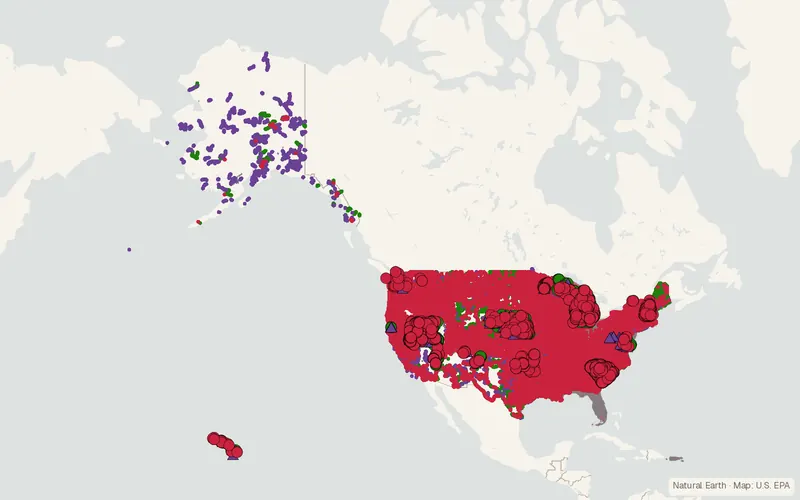
CartaTerra can export this layer as GeoPackage, Shapefile, GeoJSON, KML, CSV, or GPX.
Source and attribution
- Publisher
- U.S. EPA
- License
- Public domain
- Commercial use
- Yes
- Attribution required
- No
- Modification allowed
- See publisher
- Redistribution allowed
- See publisher
- Share-alike
- No
- Region
- United StatesUS
- Type
- Vector
- Extent
- -179.217.6-64.571.4West, south, east, north. Approximate region extent.
Related datasets
- ElevationUSGS 3DEP LiDAR Point CloudsVectorUnited StatesDEMLidarLiDAR point clouds cover the United States, Hawaii, and its territories.
- ElevationUSGS Historical Topographic Map Collection (HTMC)RasterUnited StatesDEMScanned USGS topographic maps of every scale, printed from 1884 to 2006.
- Elevation3D Elevation ProgramRasterUnited StatesDEMLidarElevation models, including lidar-derived surfaces where they exist.
- ElevationNOAA Continuously Updated DEM (CUDEM)RasterUnited StatesDEMBathymetrySeamless coastal topography and bathymetry models.
- ElevationCoastal National Elevation Database (CoNED) topobathymetric modelsRasterUnited StatesDEMLidarBathymetryFloodCoastlineCombined land and shallow seafloor elevation along US coasts for flood and storm surge work.
- OceansContinually Updated Shoreline Product (CUSP)VectorUnited StatesCoastlineNOAA's continually updated national shoreline for the US, from recent high-resolution sources.