

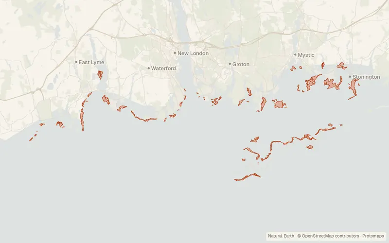
Eelgrass Beds 2017 Polygon (Connecticut)
Connecticut Department of Energy and Environmental Protection (DEEP)
- License
- Public domain
- Commercial
- Yes
- Format
- Several
- Coverage
- Connecticut, United States
- Projection
- EPSG:2234
- Last updated
- 31 Oct 2019 · Update frequency Irregular
Eelgrass polygons interpreted from four-band orthophotos flown on 28 June 2017.
CartaTerra can export this layer as GeoPackage, Shapefile, GeoJSON, KML, CSV, or GPX.
Source and attribution
- Publisher
- Connecticut Department of Energy and Environmental Protection (DEEP)
- License
- Public domain
- Commercial use
- Yes
- Attribution required
- No
- Modification allowed
- Yes
- Redistribution allowed
- Yes
- Share-alike
- No
- Region
- United StatesUS · CT
- Type
- Vector
- Extent
- -72.282941.1535-71.895241.3499West, south, east, north. Data extent.
Related datasets
- HydrologyAquifer Protection Areas Set (Connecticut)VectorUnited StatesHydrographyGroundwaterWellhead protection areas around large public supply wells in Connecticut.
- HydrologyConnecticut Dams - Public UseVectorUnited StatesHydrographyDamsDams, dikes, and similar structures registered for dam safety in Connecticut.
- HydrologyConnecticut Hydrography SetVectorUnited StatesHydrographyRiversLakesWetlandsRivers, lakes, marshes, canals, and shorelines in Connecticut from USGS quads.
- HydrologyDrainage Basin Set (Connecticut)VectorUnited StatesHydrographyWatershedsRiversLakesNested drainage basins for rivers, streams, lakes, and ponds in Connecticut.