

Tax Lots (District of Columbia)
Department of Buildings
- License
- Attribution
- Commercial
- Yes
- Format
- Several
- Coverage
- District of Columbia, United States
- Last updated
- Added to findgis 30 Oct 2026 · Update frequency Irregular
Lots usually numbered 800 to 1999 inside a square, filed from tax plats and distinct from record lots.
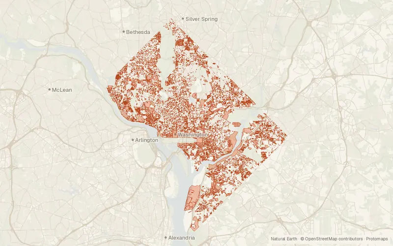
CartaTerra can export this layer as GeoPackage, Shapefile, GeoJSON, KML, CSV, or GPX.
Source and attribution
- Publisher
- Department of Buildings
- License
- Attribution
- Commercial use
- Yes
- Attribution required
- Yes
- Modification allowed
- Yes
- Redistribution allowed
- Yes
- Share-alike
- No
- Region
- United StatesUS · DC
- Type
- Vector
- Extent
- -77.11438.8104-76.910638.996West, south, east, north. Data extent.
Related datasets
- Public landDistrict Government Land (Owned, Operated, and or managed) (District of Columbia)VectorUnited StatesProperty that the District of Columbia government owns, operates, or manages.
- Public landParks and Recreation Areas (District of Columbia)VectorUnited StatesParksRecreation sites and parkland in the District of Columbia, noted with amenities.
- Points of interestAddress Points (District of Columbia)VectorUnited StatesAddressesBuildingsRoadsStreet addresses placed on buildings throughout the District of Columbia.
- BoundariesWashington DC Administrative BoundaryVectorUnited StatesWashington DC's jurisdictional line, digitized from 1995 and 1999 map sources.
- BoundariesAdvisory Neighborhood Commissions from 2023 (District of Columbia)VectorUnited StatesNeighborhood advisory areas in Washington DC as mapped for the 2023 commissions.
- BoundariesWards from 2022 (District of Columbia)VectorUnited StatesElection wards for 2022 in the District of Columbia, carrying 2020 census figures.