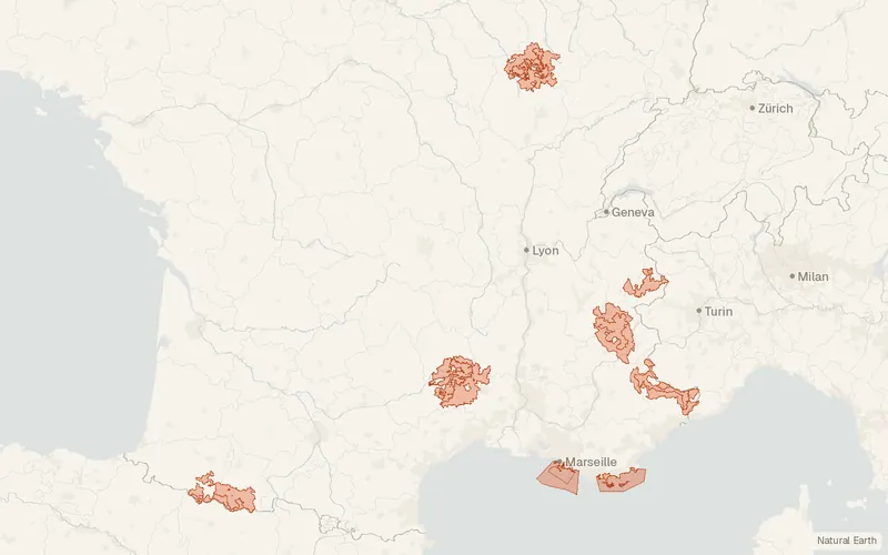
Contours des 11 Parcs nationaux de France
Parcs nationaux de France
- License
- Attribution
- Commercial
- Yes
- Format
- GeoJSON
- Coverage
- France
- Last updated
- Added to findgis 29 Oct 2026 · Update frequency Irregular
Contours des 11 Parcs nationaux de France.
Some publishers block opening this file in another site. CartaTerra will offer a download and upload instead.
Related datasets
- Protected areasEspaces naturels protégés – FranceEspaces naturels protégés France for mapping.
- BoundariesADMIN EXPRESS, ADMIN EXPRESS COG, ADMIN EXPRESS COG CARTO, ADMIN EXPRESS COG CARTO PE, ADMIN EXPRESS COG CARTO PLUS PE – FranceADMIN EXPRESS ADMIN EXPRESS COG ADMIN EXPRESS COG CARTO ADMIN EXPRESS COG.
- BoundariesParcellaire Express (PCI) – FranceParcellaire Express France for mapping.
- LocationBD TOPO® – FranceBD TOPO France for mapping.
- HydrologyBD Topage® - Métropole 2026 – FranceBD Topage Métropole France for mapping.
- HazardsBase de Données sur les Incendies de Forêts en France (BDIFF)Base de Données sur les Incendies de Forêts.