High Resolution Digital Elevation Model (HRDEM)
Natural Resources Canada
- License
- Attribution
- Commercial
- Yes
- Format
- GeoTIFF
- Coverage
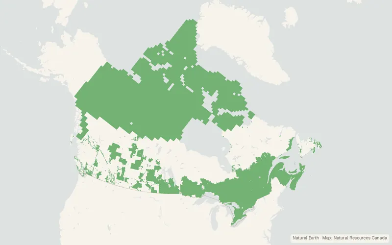
- Canada (partial), 1–2 m
- Last updated
- Added to findgis 27 Oct 2026 · Update frequency Irregular
High-resolution 1 to 2 m elevation models covering parts of Canada.
CartaTerra can export this layer as GeoPackage, Shapefile, GeoJSON, KML, CSV, or GPX.
Related datasets
- HydrologyNational Hydro Network - NHN - GeoBase Series (Canada)National Hydro Network NHN GeoBase Series.
- Geology and soilsSoil Landscapes of Canada (SLC) derived from V3.1 and V2.2 – Cartographic 1MSoil Landscapes of Canada derived from and Cartographic.
- BoundariesCanVec Topographic Data of CanadaTopographic base layers for mapping at 1:50,000.
- Public landAboriginal Lands of Canada Legislative BoundariesAboriginal Lands of Canada Legislative Boundaries.
- HazardsCanadian Forest Fire Danger Rating System (CFFDRS) Fire Behaviour Prediction (FBP) Fuel Types 2024, 30 MCanadian Forest Fire Danger Rating System Fire Behaviour Prediction Fuel Types.
- HazardsCanada Landsat Burned Severity (CanLaBS v2): a Canada-wide Landsat-based 30m resolution product of burned severity since 1985.Canada Landsat Burned Severity a Canada-wide Landsat-based resolution product of burned.